Sunday, June 21, 2009

Day 64: Toronto ON to Newport VT


Friday, June 19
Toronto ON to Newport VT
Odometer begin: 118,822
Miles traveled: 451
Wx: overcast, foggy, rain, high 60s F
States traveled: ON, VT

The last long stretch today. We landed at my Mom’s house at 4:30 pm.

Some final numbers

Totaled Miles traveled with Subie: 11,473

Gallons of gasoline purchased: 381.8 (30 MPG)
Most expensive gas: $4.11 Ontario
Least expensive gas: $1.89 Virginia

Unusual (for us) Animals sighted: Pika, Elk, blonde and brown Black Bears, Grizzly, Alligator, Prong Horn, Big Horn Sheep, Mountain Goat, Mule Deer, Black Tailed Deer, Marmot, Bison, Armadillo, Golden Eagle, California Condor, other birds not identified and various lizards.

States and Provinces traveled: NH, VT, NY, NJ, PA, MD, WV, VA, TN, GA, FL, AL, MS, LA, TX, NM, AZ, UT, NV, CA, OR, WA, BC, ID, MT, WY, SD, MN, WI, IL, IN, MI, ON, QB


Thank Yous: To our families for supporting our decision to go on this journey
Joan and Fran and Kim for watching Apollo (and Sue and Lori for offering to watch him). Rick and Jay for the Vegas advice. Mary for the America The Beautiful Pass. Jen, Corey, Laurie, Sid, Sue, John, Scott, Karen, Pat, Melissa, Sam B, Leslie, Matt, Sam M, Christy, Stephen, Kim, Dave, Moriah and Patric for putting us up for a night or two so we didn’t have to sleep on the ground the whole time! Thank you to all who offered advice on where to go and what to see and do. And for all followers and commenters on the blog, thanks for making it fun to write.

Thursday, June 18, 2009

Day 63: Toronto ON


Thursday, June 18
Toronto ON
Other: We could finally see the whole CN Tower at 5:oo pm when the clouds rose.
Wx: overcast, foggy, rain, high 60s F
States traveled: ON

We walked around the Toronto today, checking out what the city had to offer. If you want to see art or history in this town, it appears that you have to be willing to part with quite a few Yul Brynners. We did catch The Second City: Chicago, Toronto, traveling to your town, you’ve got to see these guys. The Toronto show currently running is 0% Down, 100% Screwed, it was great!
As today is our last real day of the trip, tomorrow we are back into familiar territory and staying with my Mom for a few days, we came up with the following,

You know when you’ve been on the road when:

Someone walks into your locked room at 2:30 in the morning, you say “ah” and you can go back to sleep, waking up in the morning and you either think it was a dream or you don’t really care. With only a 10th of a millimeter of nylon between you and the worst animals in the US and Canada for the past two months, one drunk Canadian doesn’t seem such a threat, eh?

Housekeeping stops by your room while you are taking a nap but you tell them they can come in anyway. Did I mention that Brian sleeps and naps in the nude?

When you take four showers a day just for the hot water…

Ramen, black beans and cheese sticks is a balanced meal, with all two color groups.

You’ll turn over your pepper spray but not your blackened banana to customs. You may never know when that extra potassium may come in handy.

You spray your T-shirt with Fabreeze, let it flap around in the wind in the back of your car for a while before you wear it for the 10th day, just so that it is clean again.

Day 62: Kalamazoo MI to Toronto ON

Wednesday, June 17
Kalamazoo MI to Toronto ON
Odometer Begin: 118,439
Miles traveled: 443
Time spent traveling: 7.5 hours
Other: 1 hour in Toronto traffic…fun.
Wx: overcast, foggy, rain, high 60s F
States traveled: MI, ON

We made the trek today with 2 stops for espresso, (chai and then a latte for me). It was all highway travel in heavy rain at times. We crossed the border at Port Huron. There is a seven lane customs there! Quite impressive and a lot of cars. Our border agent was very friendly and asked us for the umpteenth time how we can afford to travel for two months. He actually asked if we were independently wealthy.
I can’t believe how many people ask this question. If I met people who were traveling (before this trip), I would have thought it, but never asked! I’m not offended just surprised. We explained that Brian telecommutes and that we live frugally. Camping and making all our meals really cuts down on the cost of things. We are not fussy so that helps.
We are in Toronto for two nights, cities always cost more, but we are staying at a hostel, (the Clarence Castle) again private rooms cost more but MUCH less than a hotel. So we’ll probably see a show while we are here and get some dinner out but you budget for those city side trips.

Tuesday, June 16, 2009

Days 60 &61: Madison WI to Kalamazoo MI


Monday, June 15
Lakefield MN to Madison WI
Odometer Begin: 117,735
Miles traveled: 404
Time spent traveling: 6.5 hours
Other: We went and saw Wolverine finally!
Wx: mostly sunny, high 70s F
States traveled: MN, WI

Not a lot happening these days. Just driving, it is kind of boring. You know those days where you have no plans and there is not much to do so you just lay on the couch and you would be eating Ben & Jerry’s but you just can’t move yourself from the couch to the freezer? It is kind of like that. We are on interstates now and driving through miles of farm country.

Tuesday, June 16

Madison WI to Kalamazoo MI
Odometer Begin: 118, 139
Miles traveled: 300
Time spent traveling: 5 hours
Other: Paid in tolls; $5.85
Wx: cloudy, high 70s F
States traveled: WI, IL, IN, MI

We are truly back in the east. The tolls have started up again and we are back in the Eastern time zone. Also for no apparent reason Garmina took us off I-90 into a eastern Chicago neighborhood for some sight seeing, it was great… We are ending the day’s travels in Kalamazoo (say that 3 times fast).

Monday, June 15, 2009

Day 59: Badlands National Park SD to Lakefield MN


Sunday, June 14
Badlands National Park SD to Lakefield MN
Odometer Begin: 117,355
Miles traveled: 380
Time spent traveling: 6 hours
Other: There is a Chamberlain MN!
Wx: mostly cloudy , rain then sun high 70s F
States traveled: SD, MN

We continue east; crossing into the Central time zone and Minnesota. We chose Kilen Woods State Park for the place to set up camp for the night. I got in a quick trail run before dinner which felt great to stretch the legs. One thing I remember about the last time I was in MN is that it is BUGGY! It didn’t disappoint my expectations. Dinner was linguini and Italian sausage, which will also be lunch tomorrow!

Sunday, June 14, 2009

Day 58: Riverton WY to Badlands National Park SD

Saturday, June 13
Riverton WY to Badlands National Park
Odometer Begin: 116, 880
Miles traveled: 475
Time spent traveling: 8.5 hours
Other: Cost of entry to Mt. Rushmore we didn’t pay: $10. You can get the same view from outside of the park.
Wx: mostly sunny high 70 F, thunder storms at night
States traveled: WY, SD

We drove across the plains today past Mount Rushmore, ending out drive at Badlands National Park. Badlands is a very unique area of small canyons and sharp rock peaks. We camped at Cedar Pass Campground. Our friend Dave had told us about Sage Creek area to camp in and I was really looking forward to that but it turns out they close the road after heavy rain storms and June is the rainiest month here.

S Dakota

Friday, June 12, 2009

Day 57: Yellowstone NP to Riverton WY

Friday, June 12
Yellowstone National Park WY to Riverton WY
Odometer Begin: 116, 633
Miles traveled: 247
Time spent traveling: 7 hours
Other: Full dinner for 2 at Taco Bell: $4.76
Wx: mostly cloudy high 60 F, showers
States traveled: WY

We left Yellowstone this morning and drove through the northern part of Grand Teton National Park.
From Grand Teton and WY
We crossed the continental divide a few times and find ourselves on the Atlantic side for the remainder of the trip. As we make the push east our thoughts begin to go ahead of us and start thinking of our next step. We have really enjoyed this trip so far and want to be fully in the trip until the end, since this is a once in a life time opportunity.
From Grand Teton and WY

Day 56: Yellowstone National Park

Thursday, June 11
Yellowstone National Park WY
Odometer Begin: 116, 505
Miles traveled: 128
Time spent traveling: 6 hours
Other: Old Faithful geyser ruptures every 90 minutes +/-
Wx: mostly cloudy high 50s F.
States traveled: WY

So, no snow last night but it was cold. We started out the day at Mammoth Hot Springs Lower Terrace. It is a terraced area of white, yellow and orange, plus steam. We decided that we would drive the interior loop of Yellowstone. We checked out the falls, they were cool, but we have seen falls before. The yellow walls of Yellowstone canyon were beautiful. We headed by the lake next which is enormous and then through a wildlife corridor where we saw LOTS of Bison.

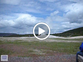
We ended up at Upper Geyser Basin, where Old Faithful is at around 12:45. Old Faithful erupts every 90 minutes and the next eruption was at 1:15 ish. We with at least 3,000 others waited for the show. Click on photo below to watch short movie.
From Yellowstone
It was cool but the real show is from Grand Geyser, which is less predictable. They estimated that today it would erupt between 9:30 AM and 1:30 pm. We got there at around 1:45 pm and it started as soon as we walked up, no joke. How is that for timing? Grand geyser is the biggest in the park and last for 7-20 minutes. There must have been at least 100,000 gallons of water coming out of it!

Tonight we camp at Norris Campground which is much better and there is even a Ranger Talk on the history of Yellowstone we may check out.

Yellowstone

Wednesday, June 10, 2009

Day 55: Glacier NP MT to Yellowstone NP WY

Wednesday, June 10
Glacier National Park MT to Yellowstone National Park, WY
Odometer Begin: 116, 079
Miles traveled: 426
Time spent traveling: 8 hours
Other: Percentage of chance of snow forecasted for tonight: 30%
Wx: mostly sunny 40s to 60s F.
States traveled: MT, WY

We stayed dry for the most part with just the feet of our sleeping bags getting wet from touching the tent. In the morning there was a nice coating of ice over everything! We also had a couple visitors to the campsite, a male roughed grouse that was doing his wing beating thing, not minding at all our presence and Frank, our white tail deer mascot who grazed on the outskirts of the site. We did see a herd of Big Horn Sheep with binoculars on the hillside above the campground and a moose on the drive out. We also saw a Pronghorn (antelope) and Elk. A good day to see wildlife.

We drove through prairie land of Montana between the two parks. Unfortunately, a truck hauling gravel threw a stone at the windshield and what started out as a tiny gouge grew to a pretty good crack in about an hour! We’ll probably have to get that fixed too!
From Yellowstone

Upon entering the park at the North entrance we stopped at Mammoth Campground. Brian thinks I always should be positive in the blog but I woke up on the wrong side of the bed this morning so, it is the worst campground I have seen in a National Park or Forest! He took the picture of the site at an angle so it looks better.
From Yellowstone
We had Santa Fe Chipotle Soup for dinner and then went for a small trek up the hills around the campground. We didn’t see many animals (just a small herd of Elk with 5 calves in tow who were super cute) but we did see a lot of poop!

Day 54: Glacier National Park MT

Tuesday, June 9
Glacier National Park MT
Odometer Begin: 115,945
Miles traveled: 134
Time spent traveling: 3.5 hours
Other: First rain on tent in 50 days!
Wx: mostly cloudy, rain, sleet, haiil, low 40s F
States traveled: MT

We packed up our things after a warm breakfast of a ham, black beans and egg scramble. Since the Going to the Sun road is not open yet, we had to drive around the southern border of the park on Highways, 2, 49 and 89. It is a very pretty drive so we didn’t mind much. The east side of Glacier is quieter which suits us and it also way more breathtakingly beautiful. The Mountains are sharp and jagged and just amazing! We got to the Many Glacier campground around 12:30, found our site and set up the tent. Rain was coming so we put the tarp up over the table. We’d decided to hike into Grinnell Glacier and see if we could spot any Big Horn Sheep or Mountain Goats. The hike is definitely one of the highlights of the trip. It follows a valley by several lakes and then climbs up to look over Grinnell Lake. We are not exactly sure where the glacier was among the snow or if it is still there because a sign at the trail head said it was decreasing rapidly in size. We did see Mountain Goats off in the distance that we could look at with binoculars. We did not see and grizzly or black bears but I guess they were active in that part of the park during the day.

When we got back to camp we were getting dinner ready when it started to rain. Because of the rain we ended up getting in the tent around 6:30 and reading books. We had met a couple of English blokes (father and son) who were actually from NH and had an RV. They came over to check on us in the rain and invited us over to warm up in their heated RV. We went over for a while, and had ginger snaps and chocolate chip cookies…I was happy. The rain continued through the night but we could see that we were just below the snow line, I think snow may have been better because the tarp sprung a leak but we were staying mostly dry.

There are a lot of photos here but they are pretty stunning if I do say so myself...

Tuesday, June 9, 2009


Monday, June 8
Troy MT to Glacier National Park MT
Odometer Begin: 115,784
Miles traveled: 161
Time spent traveling: 4.5 hours
Other: We saw 1 common loon in the lake
Wx: cloudy & misty high 60s F then sunny high 60s F
States traveled: MT

Off to Glacier National Park today. We weren’t sure how much of the Going To The Sun road was going to be open yet, so we got to the park and went straight to the Visitor Center. The ranger was very helpful, he suggested a few campgrounds and hikes. We could only get to Avalanche area of the road so we chose a campsite at Sprague Creek campground, set up our tent at a sweet site on the edge of McDonald Lake and drove up the remaining 12 miles of the road that we open. There we parked and decided to hike the 2 miles out to Avalanche Lake. Us and everyone else. Parks being what they are always crowded but since this was the end of the road, it seemed like everyone had the same idea. The lake is amazing! The steep snowcapped mountains jut right out of the lake. We headed back to the car and had a yummy dinner of black bean quesadillas, I had been thinking about them ALL day!

Monday, June 8, 2009

Day 52: Rossland BC to Troy MT

Sunday, June 7
Rossland BC to Troy MT
Odometer Begin: 115,647
Miles traveled: 137
Time spent traveling: 4 hours
Other: Minutes spent at the US border: 5, the fastest re-entry ever!
Wx: cloudy high 60s F then sunny high 60s F
States traveled: BC, ID, MT

Today we were going to go to Banff National Park and then head out back to the US tomorrow. But fate had other plans so we turned toward the US border in Idaho instead. Another gorgeous drive. We spent the night at Yaak River Campground in the Kootenai National Forest, which is a beautiful spot which we had practically to ourselves. Unfortunately, while sorted photos I realized we didn’t take any of British Columbia. Trust me, it is breathtaking.

Montana

Day 51: Deception Pass WA to Rossland BC

Saturday, June 6
Deception Pass WA to Rossland BC
Odometer Begin: 115,245
Miles traveled: 402
Time spent traveling: 8 hours
Other: Minutes spent at the Canadian border: 20
Wx: cloudy high 60s F then sunny high 70s F
States traveled: WA, BC

We were heading to British Columbia toady but couldn’t decide which route to take. Our choices were enter Canada in Washington or drive through the Northern Cascades and then crossing up. We flipped a coin and the coin said to spend more time driving in BC. We changed our minds and chose driving through northern Washington. The Cascade mountains are incredible! Today also marked the first change in weather that we had had in about 40 days. We wore pants all day and didn’t have sun until later in the day. We reached Rossland around 6:30 and met up with our friends Patric and Moriah for dinner.
N Washington

Friday, June 5, 2009

Day 50!!: Upper Hoh Rd to Deception Pass WA

Friday, June 5
Upper Hoh Rd (south of Forks WA) to Deception Pass WA
Odometer Begin: 115,060
Miles traveled: 185
Time spent traveling: 8 hours
Other: Number of times we saw the word “Twilight” on main street in Forks; 5
Wx: sunny low 80s F
States traveled: WA

We got up and out today, leaving the rainforest of Olympic for the mountains. On the way to Hurricane Ridge we drove through Forks. If you don’t keep up with female teenage culture, you may not know why Forks and Twilight go hand in hand. If you really want to know, click here. Forks is a small town but reminded me of home in that if seem to emerge out of the timber industry and it is simple. Although,… there is at least 3 espresso stands in town.

It was cloudy and cool in Forks but as soon as we turned inland and east the clouds gave away to warm sunshine. Next on route 101 was Crescent Lake, which is absolutely gorgeous. The lake is large and clear and the mountains start right at it’s shores.

We took the drive up to Hurricane Ridge in the Olympic National Park and the views did not disappoint. We saw alpine meadows in bloom, snowcapped mountains and Black Tailed Deer. We had a 2:15 ferry reservation in Port Townsend, which is like an upscale Eastport ME with a paper mill on the outskirts of town…smelled faintly familiar. On the 35 minute ferry ride we saw many water fowl and even a seal! We ended today at Deception Pass State Park, with another great campsite and chicken fajitas for dinner.

We are off to British Columbia tomorrow and therefore will only post text messages from Brian’s phone to the blog. We will post photos when we reach the US again.
OP to mainland

Thursday, June 4, 2009

Day 49: Quinault WA to Upper Hoh Rd

Thursday, June 4
Quinault WA to Upper Hoh Rd
Odometer Begin: 114,968
Miles traveled: 92
Time spent traveling: 2 hours
Other: Miles run this morning: 4
Wx: sunny low 90s F
States traveled: WA

We had a leisurely morning with today being a short travel day. We got up and ran the Quinault Rain Forest Loop. We then had eggs, using the last of our fuel and packed up. Along the drive up 101 we stopped a couple times looking for more fuel with no luck.
The Olympic National Park has three ecosystems. The ocean, the rainforest and mountains. We stopped by the ocean first were it was probably in the 60s. We then took Upper Hoh Road to the Hoh entrance of the park to the Hoh Rainforest. We found fuel (yay!) at Peaks Adventure and dinner was saved. The rainforest was cool. We started out on a small hike that was similar to this morning but a female Elk, (do they call them cows?) put an end to that one. Elks are giving birth right now and we were told by Rangers and signage to give the Elks room, as they are aggressive this time of year. So we turned around and hiked the short Hall Of Mosses trail instead, which I have to say, I thought was a cooler trail. It took us through old growth rainforest. It was not totally what I was expecting given the weather is hot and dry but it was lush and green and cool…er.
We found a free campsite managed by the state of Washington by the Willoughby Creek, which runs quite swiftly and is glacial runoff so we are not going in it.
Olympic NP

Day 48: Shelton WA to Quinault WA

Wednesday, June 3
Shelton WA to Quinault WA
Odometer Begin: 114,873
Miles traveled: 95
Time spent traveling: 2 hours
Other: Cost for a new clutch and part of the exhaust: $1040...damn
Wx: sunny low 90s F, which isn’t supposed to happen in the Olympic Pen!
States traveled: WA

So no movie last night, because it was either Up, which is Pixar so it could have been good, or Night At The Museum 2 (or whatever). We watched House MD reruns instead. But yesterday did give me a chance to catch up on the Fug Girls and to take off the month and ½ old red nail polish on my toes.
Today we dropped Subie off to get a the new clutch and were told it was going to be about 6 (!) hours. Robin, the office manager for Transmission Plus drove us back to the hotel were we were graciously given the check out time of 11:30 as opposed to 11:00 which everyone else had to adhere to. We watch some POINTLESS television…although the History Channels show about ancient alien astronauts was entertaining. We then checked out and walked toward downtown to Suzan’s Grill for lunch.
After that we strolled over to a shady area by the Taco Bell and across the street from the Wal-Mart…scenic. Upon checking in with the guys over at the Transmission Plus and finding out Subie needed a new part of the exhaust too, we decided to “hike” around Wal-Mart. We ended up buying books to read. We walked the mile and ½ back to Subie only to find no shade so we ended up walking a little further and sitting on the shady side of a vacant building on the corner of two major roads…lovely. The car was ready at 5 so we picked her up, transferred our savings to a silver “account” with four wheels and headed around to Olympic National Forest where we scored the best campsite so far at Willaby campground. A swim was in store, and then off to read our new book purchases.
S Olympic Pen

Tuesday, June 2, 2009

Day 47: Puyallup WA to- Subie is in the infirmary

Tuesday, June 2
miles travelled: 63
Other:Mileage when transmission gave up the ghost: 114, 865

Well Subie, who has been crankin' along through all we asked of her, gave out on us today. We made it out to US 101 and Port Angeles was on the horizon when the clutch started to slip. The final straw was going out to pass a car and she just didn't want to stay in fifth. We selected the Auto Services option on Garmina and she lead us to Transmission Plus. They have to order a clutch kit for the ol' girl and will not be able to work on it until tomorrow. So, we find ourselves in Shelton, WA. We are going to see what the local movie theater has to offer...we'll keep you posted.

Day 46: Portland OR to Puyallup WA


Monday, June 1
Portland OR to Puyallup WA
Odometer Begin: 114,566
Miles traveled: 243
Time spent traveling: 5 hours
Other: Date of Mt. St. Helens eruption: May 18, 1980
Wx: sunny low 80s F.
States traveled: OR, WA

We had a small crisis this morning while leaving Portland. Garmina wasn’t making sense! The directions she was giving us were crazy out of the way and she kept “recalculating” while we were on interstate 5 without giving us any directions. What were we going to do? Were we going to have to READ a map and come up with our own directions? How would we know what time we would arrive? What would happen if we missed a turn? Were we going to have to start paying attention to road signs?!! It was a sad moment, but then we remembered that we had set the system to Pedestrian yesterday, so she was giving us walking directions, of course I-5 didn’t exist in that universe. We reset the system to Automobile and peace and calm was restored.
We visited the northwest side of Mt St Helens today, which was pretty crazy to see and read the incredible stories of the survivors and witnesses. Then it was up to Puyallup to see Kim and Dave, who just moved out from Gorham. Tomorrow it is off to Olympic National Park.
Mt St Helens

Monday, June 1, 2009

Day 45: Portland OR

Sunday, May 31
Portland OR
Wx: sunny low 80s F.
States traveled: OR

Today we checked out the area of the city that we are staying in. We had dined street side for lunch, browsed the Saturday Market and then caught a session at Kells Irish Pub for dinner.
Portland

Sunday, May 31, 2009

Day 44: Diamond Lake OR to Portland OR


Saturday, May 30
Diamond Lake OR to Portland OR
Odometer Begin: 114,
Miles traveled: 200 ish
Time spent traveling: 5 hours
Other:
Wx: sunny low 80s F.
States traveled: OR

Up to Portland we went. Along the way we got the oil changed in Subie and also discovered that you cannot pump your own gas in Oregon, although they have pay-at-the-pump, which is kind of weird. Our friend Scott hooked us up for 2 nights in Portland with a really nice hotel. Thanks Scott! Portland is in the midst of the month long Rose Festival, Saturday’s night activity was the Starlight Parade. The parade can attract 500,000 people. We caught some of the parade, ate dinner and then saw some more. The floats and people are lit up!

Friday, May 29, 2009

Day 43: Crescent City CA to Diamond Lake OR

Friday, May 29
Crescent City CA to Diamond Lake OR
Odometer Begin: 113, 086
Miles traveled: 235
Time spent traveling: 7 hours
Other: Depth of Crater Lake which is the deepest lake in the US; just under 2,000 feet.
Wx: sunny low 80s F.
States traveled: CA, OR

We said goodbye to Christy, Stephen, Ian and Miles (their dog) and started out on Highway 199 which winds along the Smith River. It is a very beautiful ride. We then followed the Rogue River up to Crater Lake National Park. Much of the park is still closed due to snow, but we could get in the west entrance and drive up to the lake. About a mile was cleared on the rim road so we did get some great views. Crater Lake was formed about 7,700 years ago when a volcano erupted and then collapsed. The lake is thought to be the cleanest in the world because it is fed by rain and snow only. Nothing runs into or out of the lake. It’s clarity gives the water a brilliant blue color.
After our visit we headed north and found a Forest Service campground on Diamond Lake in the Umpqua National Forest. This campground is massive and even still it was tough finding a site on the water, but we did find one that a RV wouldn’t be able to pull into…yea tents!
Crater Lake

Day 41: REDWOODS!

Thursday, May 28
Crescent City CA
Odometer Begin: 113, 059
Miles traveled: 27
Time spent traveling: 1 hours
Other: Camp songs that Christy and I could remember; uncountable!
Wx: sunny high 70s F. (Which we have been told is rare up here)
States traveled: CA

A day with the giants today!
Redwoods

We drove out along a dirt road in the Redwoods National and State park into the Stout Grove and hiked the Boy Scout Tree trail. We were continuously blown away by the sheer mass of these trees. After the hike we stopped for a picnic lunch and swim along the Smith River. This river too was awe inspiring because of it’s clarity and deep aqua color. It was also very refreshing (read cold) and had offered good cliff jumping. We then went back to Christy and Stephens where we had dinner followed by a little fire and s’mores and time in the hot tub. All in all a great day!

Thursday, May 28, 2009

Day 41: St. Helena CA to Crescent City CA


Wednesday, May 27
St. Helena CA to Crescent City CA
Odometer Begin: 113,
Miles traveled:
Time spent traveling: 6 hours
Other: Cost of driving through a Redwood; $5 (we didn’t do this tourist trap though)
Wx: sunny high 80s then 70s F.
States traveled: CA

We bid farewell to Napa today and headed up to Crescent City; to see some Redwoods and visit my friend (from back in the camp days!) Christy, her husband Stephen and their son Ian. The drive took us up Routes 1 and 101, it was gorgeous! Past vineyards, along the ocean and then through Redwood groves, it is a pretty good drive.
After a yummy dinner of lasagna, we went for a walk along the ocean, where we could hear the sea lions but they were too far away to see.

Wednesday, May 27, 2009

Day 40: Napa Valley CA

Tuesday, May 26
Napa Valley
Odometer Begin: 113, 659
Miles traveled: 55
Time spent traveling: 6 hours
Other: Year of the Paris wine tasting that marked California as a serious wine creator: 1976 (also the year Amy was born…good year)
Wx: sunny high 90s F.
States traveled: CA
We slept in today! It was sooooooo nice, no barking dogs and even the birds seemed to sleep in! Today we started out at Artesa, we had more than one friend recommend them to us’ so we had to go. We have never seen their wines before but they had a very nice Chardonnay, Pinot Noir and a blend they call Element which I really liked. One of wine tasting peeps behind the bar, there is probably some fancy French name for what they are, lets just say bartender (oh sacre bleu!), recommended a newer winery called Miner Family Vinyards and gave us VIP cards for a free tasting (free…that’s good). It also is on the Silverado Trail which is less developed than the main Napa strip. We met some lovely people from outside of LA there who gave us their card for recommendations on places to visit in southern Cal., which was very nice! Today was the day for nice people the folks a few campsites down from us are from British Columbia and have offered to give us tips on where we should visit while there. Our last winery was Chateau Montelena. This winery starred in the movie Bottle Shock with Alan Rickman. The movie is a more fictional retelling of how California was first recognized as a serious contender in the wine world. The Chateau Montelena won the Chardonnay division in that 1976 tasting. We had some today and it is wonderful. Here are wine country photos.
cali wine country

Tuesday, May 26, 2009

Day 39: Alameda to San Francisco to St Helena CA


Monday, May 25
Alameda CA to San Francisco CA to St. Helena CA
Odometer Begin: 113, 512
Miles traveled: We’ve been tasting wine; who cares?
Time spent traveling: 3 hours
Other: Price of decent wine at Trader Joe’s; $3.99 (Purple Moon)
Wx: foggy and cool then sunny high 80s F.
States traveled: CA

Another great day. We set out in the morning for San Francisco, after hitting up the local Trader Joe‘s, we love this place!. The city was fogged in and cold this morning. We tooled around Golden Gate Park, (Wow! The Eucalyptus trees!) stuck our hands in the Pacific, saw Haight/Ashbury and of course drove over the Golden Gate bridge (north bound traffic, no toll…nice). It was so foggy that while on the bridge you could barely see the top. We also had a few glimpses of Alcatraz.
We went back into wine country stopping at a few places we commonly buy in New Hampshire. Ravenswood in Sonoma; their Zinfandel is one of my favorites. Their vineyards are gorgeous and we drove out among them for a while in the non-pretentious landscape. It was then back to the Napa Valley to visit Folie a Deux, the makers of Menage a Trois, (red, another favorite). They are now owned by the Trinchero family who also own Sutter Home, Napa Cellars and quite a few others. They also have a comparatively inexpensive wine tasting at $5 and very laid back atmosphere.
We are spending the next two nights at Bothe- Napa Valley State Park which has some beautiful trails to run. Tomorrow it is off to Cakebread Cellars and Artesa.

Day 38: Sacramento to Napa to Alameda CA

Sunday, May 24
Sacramento CA to Napa CA to Alameda CA
Odometer Begin: 113, 374
Miles traveled: 139
Time spent traveling: 3 hours
Other: The last time I saw my friend Matt; 1995
Wx: sunny high 80s F.
States traveled: CA

We headed to Napa Valley today for some winery action and luck would have it my high school friend Matt Morgan was going to be in Napa too. We met up with Matt, his wife Sam and their two kids, as well as their friends Mike and Kerry and their two kids for an afternoon of wine tasting. We met up at Peju,who has a blend called Provence, it is served cold and is 3 reds and 2 whites’ then visited Franciscan and then finished at St. Supery which has a red called Elu that was a favorite as well as a super yummy Mascato. We spent the evening at Matt and Sam’s where we had a great dinner and Matt and I retold our memories of high school. It was great to catch up and see how we had changed and how we were still the same. 2 old friends in 2 days, California

Sunday, May 24, 2009

Day 37: Groveland CA to Sacramento CA


Friday, May 22
Groveland, CA to Sacramento, CA
Odometer Begin: 113,240
Miles traveled: 134
Time spent traveling: 3 hours
Other: Number of days since we have done laundry: 11
Wx: sunny high 80s F.
States traveled: CA

We had a good breakfast at PJ‘s Café this morning. It was actually our first breakfast out since we have been on this trip. We then set out for Sacramento and to visit Brian’s high school friend Sam and his wife Leslie and daughter Julia. We had a lovely visit with the Bradshaws; took a walk around Old Sacramento and checked out a little of the Jazz Jubilee.

Day 36: Death Valley CA to Groveland CA

Friday, May 22
Death Valley, CA to Groveland , CA
Odometer Begin: 112,880
Miles traveled: 360
Time spent traveling: 9 hours
Other: Elevation gain today : 10,227 feet
Wx: sunny high 90s to 100s F.
States traveled: CA

So today was one of those days! We have been traveling for 35 days it was bound to happen… We had a good start in Death Valley, took in a hike through Mosaic Canyon
Mosiac Canyon
in very warm weather and then drove up into winter! We climbed up to Tioga Pass in Yosemite National Park at 9,945 feet. There was still 4 feet of snow in places.
Yosemite


For the most part, we have been camping for free in National Forest or BLM land on this trip. It has worked really well so far; choose a place on the map, do some quick googleing and viola! Another free evening! Today that system failed. There were several factors against us, it is Memorial Day Weekend, it is Yosemite and The Strawberry Festival. We knew it would be tough and we weren’t planning on finding a campsite in the park. The majority of the parks’ campgrounds are still closed right now as well. So, we planned on finding something in Stanislaus National Forest. I even called the Ranger Station in the district we were going to be in to see if they could make some suggestions. That was no help, just “It‘s your forest you can camp where you want“…, although she was very nice and returned my phone call; their Gail is no Chris B! (our friend who is the Visitor Information Specialist for the Whites) I already knew that. We drove down various Forest Service roads the pay campsites were full and other locations we found were high on the sketch factor. Right next to where someone was target shooting, under high tension wires, straight out of Deliverance, down a dirt road only a tank could travel or apparently where the local teenage rager was to be. It was getting later and later and the closer and closer to sunset. Brian finally called a local motel, (thanks to Garmina’s help) and told them we were looking for cheap accommodations since we had a tent and having no luck with campgrounds. They said we could put up the tent on their lawn for $25. Uh, we’ll take it! They actually have tents that it not too many people were using so they had a wash house. It was basically like an expensive campground right in town. There were 2 bikers that did the same thing. We bought some California wine and Milano cookies for salve for our wounds, cookies always make me feel better.

Friday, May 22, 2009

Day 35: Las Vegas NV to Death Valley CA

Thursday, May 21
Las Vegas, NV to Death Valley, CA
Odometer Begin: 112,624
Miles traveled: 156
Time spent traveling: 2 hours
Other: Feet below sea level today; 282
Wx: sunny high 90s to 111 F.
States traveled: NV, CA

Early wake up again. 6 am after going to bed at 12:30 am! We left Las Vegas and made our way to Death Valley National Park. To say it was a hot day is an understatement! The Badwater salt flats is 282 feet below sea level and usually is the hottest place on earth. It did not disappoint at a whopping 111 degrees! Our plan was to do a little hiking, not much, 4 miles but it was too hot so we drove around and looked at the colors and then drove to the other side of the valley to go up in elevation and down in temperature to Thorndike Campground. It is a free campground at about 7900 feet above sea level. It was much cooler and even chilly at night. Amazing place.
Death Valley

Thursday, May 21, 2009

Day 34: North Rim AZ to Las Vegas NV

Wednesday, May 20
North Rim, AZ to Las Vegas, NV
Odometer Begin: 112,352
Miles traveled: 272
Time spent traveling: 7 hours
Other: This post will be in two parts because they are so different from each other.
Wx: partly sunny high 90s F.
States traveled: AZ, UT, NV
Up with the sun at 5:30, still awake 11:30, I am tired.

Part 1: Zion National Park
We drove through the park but did not hike, which is unfortunate but a casualty of such lofty ambitions for this trip. We still got great photos and we definitely want to go back and do some hiking.
Zion


Part 2: Las Vegas Baby! A night on the strip and showers…a good combination. We stayed at the Golden Nugget, which is downtown and one of the older hotels in Vegas. It has been modernized and was a very nice experience. It is on Fremont Street which has the Fremont Street Experience, which is the covered pedestrian street that has the LED light show.
Las Vegas

Day 33: Sedona AZ to North Rim AZ

Sunday, May 19
Sedona, AZ to North Rim, AZ
Odometer Begin: 112,094
Miles traveled: 257
Time spent traveling: 4 hours
Other: Cost of a killer campsite: $0.
Wx: partly sunny low 80s F
States traveled: AZ
We were up before 6 am this morning! But we did go to bed at 8 pm too. Because Arizona does not celebrate day-light-savings the sun sets here at 7:30. We went to Sedona in search of a café with internet access. It took more effort than we expected but we found one and I was able to download Verizon’s Access manager so now I can use Brian’s blackberry as a modem, like he does on his computer. So we are fully teched up now.
We reached the Grand Canyon’s North Rim today at 12:30. The road only opened 4 days ago and they are in full swing! The campground is full and the lodge seemed to be pretty hopping as well. Upon walking to the visitor center, we saw a Condor sitting in a tree preening itself. It was number A7. You can see the numbers they were given as part of their reintroduction program. Because of the mass of people, we just hiked along the rim for a while and then drove out FS 611. It is a Forest Service road on the Kaibab National Forest. We found out about it at Frommer’s .com. It leads out to the east side of the rim and has free dispersed camping. We found a great site!
Grand Canyon

Tuesday, May 19, 2009

Day 32: Sedona AZ - Sterling Pass to Vultee Arch

Monday, May 18
Sedona, AZ
Miles traveled: on foot; 8.4
Time spent traveling: 5 hours
Other: The time it took us and two other couples to find the trail head for Sterling Pass, 30 minutes. And that was after talking with the visitor information people!
Wx: partly sunny high 90s F
States traveled: AZ

After a breakfast of eggs and pseudo-pancakes we headed down to the Oak Creek Canyon visitor center to find out about hikes. They suggested Sterling Pass to Vultee Arch seeing how it was right across from our campground. It is also in the Red Rock/ Secret Mountain Wilderness. While we were in there another couple was getting the same recommendation. We never caught their names but they were from Kansas City. We went back to the campground to park the car at our site, donned on the packs with a gallon of water each and crossed the street…no trailhead. We walked up the road a ways, …no trailhead. We went back to the campground because we saw Kansas City. They were having just as much trouble as we were. There was no campground host on duty to ask. Another camper was trying to help by using his laptop and Magellan. Still no luck. I decided to walk down the road a ways because that is how the trail head looks on the map. Finally Brian’s blackberry picked up a signal and his google search gave us the facts that it was north (up) from the campground and had an obscure trail head. So the four of us set out up the hill. …still no trail head. We followed a few non trails around the hillside and then Brian saw a van with another couple and asked them. They were from Washington and planning on the same hike. They had found the trail head after driving up and down the road for a while and were able to get us going in the right direction! The hike was beautiful and the two canyons we hiked in had Ponderosas and a ton of wildflowers (I got good photos Amy!), so it was cooler than if we were out in the direct sun, but it was about all the heat I could bear.

Upon our return to the campsite, we went for another swim in the creek. Here are our photos:
Sedona

Day 31: Gila Hot Springs NM to Sedona AZ

Sunday, May 17
Gila Hot Springs, NM to Sedona, AZ
Odometer Begin: 111,558
Miles traveled: 502
Time spent traveling: 11 hours
Other: Temperature on sign while driving through Pheonix: 107 F!!…but it is a dry heat…sweet Jesus!
Wx: partly sunny low 100s F
States traveled: NM , AZ

A Note: We have gotten so many good suggestions for the southwest from you all, but we unfortunately are limited on time so we will just have to come back and see all the places suggested!


Again with the early start…I would love to not see 6 am tomorrow (although we are in Pacific time since Arizona does not do Day Light Savings). Our plans for the morning are to “sleep in’ and have pumpkin pancakes and eggs with salsa instead of granola or oatmeal! We are in Sedona and it is absolutely gorgeous! The drive, though tortuous was well worth it. We left Gila Hot Springs, at 7:45 even after being woken up last night at 12:30 am by someone BLASTING Wooly Bully (or whatever the name is)…seriously. Then they went on to play some other music but courteously turned it down so we could only hear their sub woofers.
Our first stop today was at Saguaro National Park. We planned on hiking but seeing as it was damn hot, we opted for short walks among the cacti. Survey says: Saguaros are cool. We also saw a few Gila Woodpeckers which are also really cool, but not as cool a Pileated in my humble opinion.
We then had a quick lunch of left over mac and cheese with tuna and salsa, (it just keeps getting better doesn’t it? ) in a parking space and headed out of the park toward Sedona. Like I mentioned before it was hot and with no A/C and the west in a record breaking heat wave, the drive was rough, but we made it and once we got here it all evaporated…like any sweat in this arid land. We found a campsite at Manzanita Campground on the Coconino National Forest. According to the Coconino website, to get a campsite here you have to be early and lucky so I guess the camping gods were smiling down on us today. The campground is small, maybe 20 sites, tents only, so we kind of felt we had a good chance. It is located in Oak Creek Canyon right on Oak Creek so we set up the tent and then went straight to the creek. It was cold and refreshing and WONDERFUL! We decided to stay for 2 nights so we set up the large tent for more room and had a leisurely evening. We have currently Dave Matthews on the iPod and I am typing this at our little folding table and chair. The tent is so big that it takes us ten minutes to set it up but like I already told our friend Ryan when he gave us crap for it’s size; being able to stand up to put our pants on is a blessed thing.

Day 30: Cloudcroft NM to Gila Hot Springs NM

Saturday, May 16
Cloudcroft, NM to Gila Hot Springs, NM
Odometer Begin: 111, 276
Miles traveled: 282
Time spent traveling: 7 hours
Other: Most twisting, turning and winding road we have been on yet, NM Hwy 15.
Wx: partly sunny low 90s F
States traveled: NM
Another early start today got us to White Sands National Monument a little after 8. The drive was about an hour from Cloudcroft. Cloudcroft is a sleepy little town that looks like it may have a decent winter business with Ski Cloudcroft the local hill. During the night smoke from the fires to the north drifted over and laid down around the tops of the Sacremento Moutains as we drove down toward Alamagordo, we came out of the smoke and could see the dramatic views of the west side of the range. After spending about an hour walking the dunes of White Sands, we drove northwest to the Gila National Forest to see the Gila Cliff Dwellings National Monument.
gila

The road to get out there is quite a road, with steep grades and turn after turn after turn for over 25 miles. We found a quiet campsite on the National Forest in the “town” (about 3 houses and a general store) of Gila Hot Springs. There are hot springs just a little way from the campsite but they are on private land and the owners charge admission, so we passed and opted for a dip in the river instead.

Day 29: White's City NM to Cloudcroft NM

Friday, May 15
White’s City NM to Cloudcroft, NM
Odometer Begin: 111, 017
Miles traveled: 259
Time spent traveling: 4 hours
Other: Fee to get in to sorriest museum I have ever seen: $5 but somehow worth it.
Wx: partly sunny low 90s F
States traveled: NM
We arose early at 6:45, (although that is 8:45 at home). It was a grand morning with birds singing and combines running! We breakfasted as they say in Appalachia and then made our way to Carlsbad Caverns. We chose the “natural entrance” as opposed to the elevator entrance. We had a very silent first half of the hike until we met up with the jokers that come in on the elevator. The Caverns are amazing! The photos don’t nearly do them justice but we took some anyway.
Carlsbad
If you are ever in Southern NM don’t pass this up! We then headed up to Roswell, in search of UFO fanatics but only found the “International UFO Museum and Research Library”.
Roswell
The museum had the feel of a high school science fair. We are afraid the photos do it too much justice but that almost makes the $5 per person entrance fee worth it! After that we drove over to Cloudcroft and Lincoln National Forest in search of a non fee campsite. We found one at James Canyon quickly inside the forest borders and set up camp for the night. Dinner was another concoction of chick peas and spinach with a side of raman, but it still tastes just as good to us! Turns out our neighbors are both Bates College grads…small world.

Saturday, May 16, 2009

Day 28: San Antonio TX to White's City NM

Thursday, May 14
San Antonio, TX to White’s City NM
Odometer Begin: 110,528
Miles traveled: 489
Time spent traveling: 7.5 hours
Other: The speed limit on the interstate in western Texas: 80 MPH!
Wx: partly sunny low 90s F, HUMID then dryer
States traveled: TX, NM

We hurtled across western Texas at 80 miles per hour on most road or 70 if in a town! There is not much in western Texas just miles and miles of land. At a rest area we saw Scissortiail Flycatchers, which are apparently the state bird of Oklahoma. And we saw green energy mixed with archaic fossil fuels. Wind farm after wind farm and then oil drills. We arrived in White’s City (the entrance to Carlsbad Caverns) 15 minutes too late to get a backcountry pass so we ended up spending our first night on BLM land. Before we set up camp though we made the short hike to the entrance of Slaughter Canyon to see the bat flight. Bat flights are up to the perogitive of the bats so we only saw three. We figured it probably has to be warmer and buggier for the bats to come out en masse. The BLM for those that do not know is the Bureau of Land Management. They pretty much got all the land the Park Service and Forest Service didn’t want. Most of it is used for grazing, and mining and there isn’t any BLM land east of the Mississippi. HOWEVER, you can camp on any BLM land unless otherwise noted. So, you can just turn down a BLM dirt road and camp on the side of the road AND the BLM owns the most public lands out of any government agency, they are all over the west. Pretty much the entire state of Nevada is BLM!

Wednesday, May 13, 2009

Day 27: Coldspring TX to San Antonio TX

Wednesday, May 13
Coldspring, TX to San Antonio, TX
Odometer Begin: 110, 277
Miles traveled: 251
Time spent traveling: 5.25
Other: How long one can drive with the gas port door open and the gas cap off? Um, yeah, that would be one hour 30 minutes.
Wx: partly sunny high 80s F, HUMID
States traveled: TX

The stars at night are big and bright…! We are deep in the heart of Texas! Our drive this morning took us through splendid (I am trying to use different superlatives besides beautiful and gorgeous) ranches and meadows. It was like what Brian called “Vermont on steroids”.
We filled up with the most expensive gas so far: $2.29. Wha! Don’t they pipeline the gas in right from the refineries here? We landed in San Antonio and decided to spend the night here. Spending most of our time on the Riverwalk, a unique below street walkway on both sides of the river, lined with trees, restaurants, shops and pubs. Of course, we remembered the Alamo.
Our photos are here…
San Antonio

Day 26: New Orleans LA to Coldspring TX

Tuesday, May 12
New Orleans, LA to Coldspring, TX
Odometer Begin: 109,879
Miles traveled: 398
Time spent traveling: 9 hours
Other: Number of times an armadillo will keep trying to dig up a fire ant hill after getting stung: about 3...they must taste really good!
Wx: partly sunny high 80s F, HUMID
States traveled: LA & TX

The day dawned hot and humid! St. Bernard State Park, marooned between the Mississippi and several interstates may not be the most tranquil experience you’ll ever have. Mother Nature had to compete with the noise giving us, barred owls, coyotes, domestic dogs, cicadas, and other strange bayou sounds through the night. Not to mention all the rabbits and armadillos running around!…sleep wasn’t the best ever.
We started out on Highway 18, also known as River Road. It runs along the meandering twists of the “great muddy river” and takes you through fields of sugar cane and old plantations as well as scary, alien looking refineries. The plantations we stopped at were Laura, Jefferson and Oak Alley. We didn’t go on any tours but we looked around at what we could without paying admission. Today was hot and uncomfortable in the car with a busted A/C, so we stopped a few times just to walk through a store for it’s air conditioning.
We decided to head north of Houston to Sam Houston National Forest(a gorgeous national forest) in the search of cooler weather. We arrived at Double Lake Recreation Area at 6:30 and made a bee-line for the lake. We found our campsite for the night (many to choose from seeing as how the place was nearly empty except for us, a cyclist and the campground host). A pleasant surprise was to find cold showers in the bathrooms! After a dinner of black bean burritos and ramen (I know, that’s weird), we hit the sack at 9 pm. This time we only had the cicadas competing with the bullfrogs and fell asleep quite easily.
eastern texas

Day 25: Alpharetta GA to New Orleans LA

Monday, May 11
Alpharetta, GA to New Orleans, LA
Odometer Begin: 109,336
Miles traveled: 513
Time spent traveling: 10 hours
Other: Price for 3 beignets at Café Du Monde: $2
Wx: partly sunny high 80s F, humid, T-storms
States traveled: GA, AL, MS, LA

After sleeping in this morning and running a few errands, (such as swinging by a UPS store so I could mail home a box of clothes) we started out late to avoid the ATL traffic. Our drive took us predominantly on I-85 & I-10 through the cities, like Montgomery, Mobile and Biloxi, hitting the occasional thunderstorm along the way. We arrived at St. Bernard State Park around 7:00pm, set up the tent, took showers and then went to check out the Crescent City. Being in St. Bernard Parish, our drive in took us right through the Ninth Ward, which was the section of New Orleans that was hardest hit by Hurricane Katrina. Even now almost 4 years later, there are houses that have been repaired or rebuilt next to ones that are still being fixed up or apparently abandoned. The neighborhood that we drove through was Bywater, which is supposedly recovered better than others. The style of homes, I thought, was really charming and had a distinct style; front porches, tall narrow windows and doors, many with wrought iron embellishments and shutters. One source I found called the style “Shotgun”; usually single story with no windows on the sides and all room connected with out hallways. This was so you could open the front and back of the house and a breeze would blow through. But the neighborhood in general was run down, it was hard to tell if it was hurricane damage or if just from it being a typical old neighborhood on the outskirts of a city, where the working class neighborhoods are.
We spent time walking around the French Quarter, which has really cool French Creole architecture but since it was at night, I didn’t get good photos. We parked on Decatur St., stopped at Café Du Monde for beignets, (think fried dough but more like a donut) and then went to check out Bourbon St. It was Monday night so, we may not have gotten the truest impression but I felt it was a little over rated. It was like Hampton Beach board walk plus, Larry Flint and Jazz. New Orleans will definitely be a place we will have to visit again. But for now we just want to get into the arid southwest and do some hiking!
Louisiana


Here are our photos from Louisiana.

Monday, May 11, 2009

Day 24: Athens GA to Alpharetta GA

Sunday, May 10
Athens, GA to Alpharetta, GA
Odometer Begin: 109,270 (back with Subie)
Miles traveled: 68
Time spent traveling: 1.50 hours
Other: Odds that the AC would work, now that we need it; 100 to 1... against.
Wx: partly sunny low 80s F:
States traveled through: GA

We did laundry last night and gave Subie a bath inside and out. Because we had been away from the car for a while we had to reload everything. We also discovered that the AC lost it’s charge while the car was sitting in John’s garage. We have a leak in the line somewhere. Today on my run, I ran a dirt county route right near John’s house. It was the quintessential Georgia red dirt road. I can’t say it was the best cardiovascular run ever because I kept stopping to check out the flowers. I even went back to take photos, so here they are.
GA flowers

Our original plan was to head west today but we skipped over to Alpharetta for the evening to spend time with Pat, Melissa, Quinn and Murphy, whom we hadn't seen yet.

Saturday, May 9, 2009

Day 22: Marco Island to Athens, GA


View Larger Map

Saturday, May 9
Marco Island, FL to Athens, GA
Odometer Begin: 146,490
Miles traveled: 651
Time spent traveling: 12.25 hours
Other: Number of times we ate at a Zaxby's today: 2
If we don't see another Zaxby's for a while, I think we'll both be quite alright with it.
Wx: sunny high 80s to low 90s F:
States traveled through: FL, GA

We got a decent start this morning, leaving Marco Island at 8:15 am. We stopped to take a few photos on the way out, one of the painted dolphins around town, and one of a panther crossing sign, (we never did see any panthers though). We dropped Jen and Corey off in Fort Myers where they were staying one more night and flying out tomorrow. Then got on Interstate 75 for over 500 miles! This drive was somehow easier on us all than the long push we made from Savannah to Key West.